
Hiking Circuit : Rimbach - Ebeneck
- 2h
- 5,6km
- 312m
- Easy
This rather short hiking route takes you up to the thatched roof of Ebeneck.
The hiking route is relatively easy, but there are some places that are more difficult to climb than others.
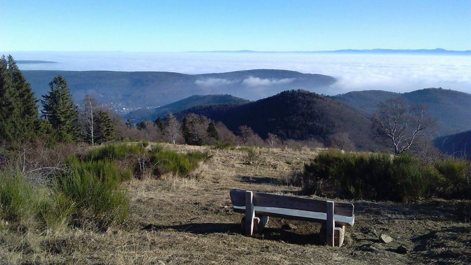
At the summit you can let your gaze wander over the wonderful and fascinating landscape of the Elsas, the mountain range of the Alps and the Black Forest.
Directions:
Town hall of the Rimbach - Munsteraeckerler 0-0,8 km:
The hike starts at the parking lot of the town hall. Now you pass the hotel " l'Aigle d'Or " on your left. Then follow the main road and turn into Murbach Street. Now follow the path (red circle) to the Munsteraeckerle. There you will find benches, tables and a small shelter.
Munsteraeckerle - Chaumes de l'Ebeneck 0,8 - 3,4 km:
Next take the path to your left towards the "Glashutte". Follow the route for 1.5 km. You will have a breathtaking view of the valley of the Rimbach. After 1.5 km, turn right onto a path that will lead you towards the Chaumes de l'Ebeneck.
Ebeneck - Munsteraeckerle 3,4 - 4,5 km:
Once you reach the prairie, follow the path to the top where you will find a bench from where you will have a fascinating view over the Elsas and the Black Forest. Go down the path towards Munsteraeckrle (red - white - red rectangle).
Munsteraeckerle - Rimbach 4,5 - 5,6 km:
Back at Munsteraeckerle follow the path with the previously mentioned signpost, on the right side of the hut towards the Peternit mountain pass. After 300 meters keep right and cross the clearing where you will find benches and tables. At the bottom of the path you will find a path that will lead you to the end of the Murbach road.
You will now arrive back at the starting point of the hike.
Additional information
- Type of hiking trail : dirt path, path
- IGN Map : 3719 OT, Rimbach
Download(s)

