
Mountain bike route: Strohberg Route
- Half-day
- 45,30km
- 1462m
- Challenging
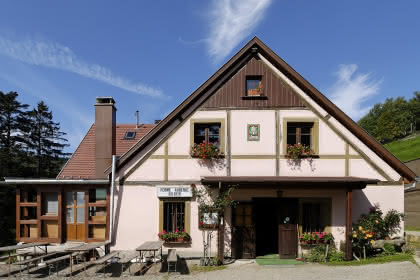
After all your hard work, you can relax. After climbing the Bannstein, Firstplan and Boenlesgrab passes, you can revel in the landscape while enjoying refreshments at the Strohberg farm-inn. From here, through shrubs and wood, you will come to Linthal, a charming village on the valley floor, to climb up to the Boenlesgrab pass and retuen to your starting point.
Level: Very difficult
Start: Bannstein Col
Distance: 45.30 km
Difference in altitude (positive gain): 1,492 m
Towns crossed: Soultzmatt, Rouffach, Wasserburg, Linthal and Lautenbach
Additional information
- Type of hiking trail : path

